


1 Photo
Officers of Traffic Hong Kong Island won the Silver Award of the first Force Mobile Application Design Competition with their mobile application “Facility AR”. They shared with OffBeat readers their design concept.
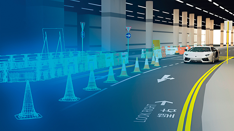
Officers supporting operations of public order events are often required to draw sketches for briefing purposes. Arrows, dotted lines or dots of various colours are usually put on the map to indicate important information such as enclosed areas, routes, locations of officers, etc. Although such sketches enable officers to gain a general understanding of the arrangement, they cannot accurately reflect other commonly used facilities such as traffic cones, mills barriers and water-filled barriers, etc., especially when road closures or diversions are required, improper placement of road signs could trigger potential traffic accidents.
While the sketches may seem simple, their preparation is often time-consuming and with limited benefits. We hope to solve these problems through the mobile application, “Facility AR”. The application uses augmented reality (AR) technology to integrate virtual objects, such as traffic signs, traffic lights, traffic cones, mills barriers and water-filled barriers and other common facilities, into the actual environment. Users can quickly draw a clear and accurate
three-dimensional action map without using a computer, making complicated action details more understandable and avoiding unnecessary misunderstanding. Users can even record short videos of the augmented reality and insert them in the operational brief.